CITY HALL
Within a few steps, City Hall Park brings together early New York civic buildings, tree shade, and the Manhattan entrance to the Brooklyn Bridge. Classical façades lend the photographs order; curved paths and Lower Manhattan streets keep the people firmly inside the city.
- BEST TIME
- Morning / Afternoon
- DURATION
- 40–60 MIN
- CHARACTER
- Historic / Classic / Civic / Formal
- COORDINATES
- 40.7128, -74.0060
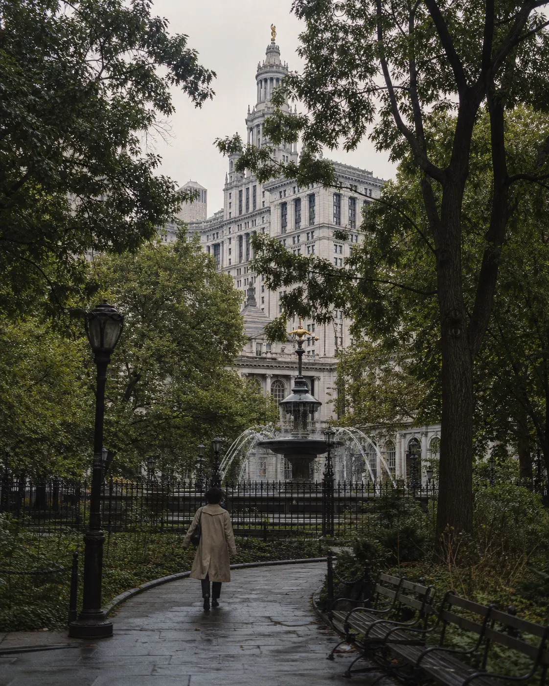
City Hall, the Tweed Courthouse, and the Municipal Building surround the park. City Hall has been in use since 1812. Curved paths, lawns, a fountain, and mature trees stand between it and the camera, so the building appears through the park instead of sitting flat behind the subject.
The Tweed Courthouse brings a heavier stone exterior and broad steps. Near Park Row, the Brooklyn Bridge tower appears farther down the street alongside the arched base of the Municipal Building. This is the Manhattan beginning of the bridge, seen through downtown streets rather than from the DUMBO waterfront below it.
Pale stone keeps its detail in morning or overcast light; later in the day, shadows give more form to the trees and the direction of the streets. The route stays in the park, on public sidewalks, and outside the buildings. Tweed Courthouse interiors and any space behind security or permission are not assumed to be available.
City Hall Park fountain and paths — City Hall framed through trees · Tweed Courthouse exterior — Stone, steps, and formal composition · Park Row / Municipal Building side — Brooklyn Bridge approach and Lower Manhattan depth
Continue to the Financial District for more Lower Manhattan architecture, or walk toward Chinatown as the civic façades give way to denser neighborhood streets.