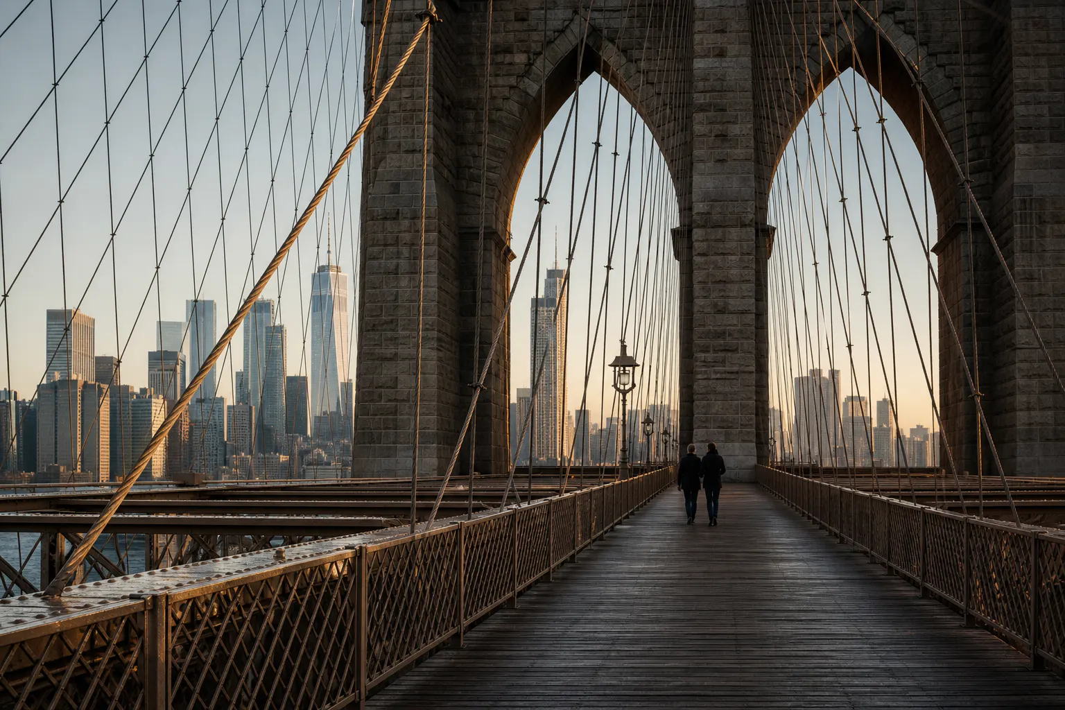
BROOKLYN BRIDGE
On Brooklyn Bridge, granite towers, diagonal stays, and suspension cables divide the city again and again. As the walk continues, either Lower Manhattan or the roofs of Brooklyn Heights slowly change behind the structure. This route photographs people moving inside the bridge itself.
- BEST TIME
- Early Morning / Avoid Weekend Afternoons
- DURATION
- 35–55 MIN
- CHARACTER
- Iconic / Architecture / Geometric / Promenade
- COORDINATES
- 40.7061, -73.9969
Opened in 1883, Brooklyn Bridge crosses the East River between Lower Manhattan and Brooklyn Heights. From the elevated pedestrian promenade, each granite arch makes a broad frame for the skyline, while cables repeat much closer to the body. The bridge is most recognizable when people remain within this geometry, not when it is left in the distance.
Walking toward Manhattan makes Lower Manhattan grow behind the stone tower. Turn around and the same promenade leads toward the lower roofs of Brooklyn Heights and DUMBO. These directions produce genuinely different photographs. They can be used in sequence, but the two skylines cannot be made to occupy one honest view.
Early morning shows the bridge structure most clearly. Weekend afternoons bring very heavy foot traffic and are best avoided. Since 2021, the dedicated bicycle path has been at roadway level, so the old shared-lane description no longer applies. A small hand-held shoot must keep the promenade open to the public; larger setups need to be checked against current NYC film-permit rules before the session.
Brooklyn-side approach — Steel transition into the elevated promenade · Granite tower arch — Stone frame and converging cable rhythm · Manhattan-facing promenade — Lower Manhattan opening beyond the bridge structure
From the Brooklyn side, continue into DUMBO for cobbled streets and the waterfront. From the Manhattan side, step into City Hall Park. The Brooklyn Bridge section itself remains on the elevated promenade.